Sunday, 11th August 2013
This was the first meet up I’d organised and led so I was a bit apprehensive. Could I actually read a map and get us all round in one piece? The time had come to find out…
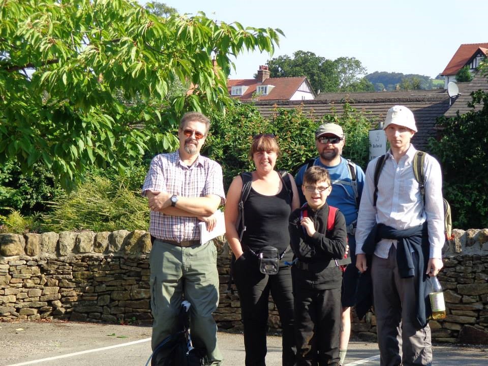
After meeting with the others in the group in Muker there was a quick introduction for those who hadn’t met each other before setting off.
The weather had turned disappointingly into rain as we set off and had us all donning the waterproofs. A quick detour to the village shop so I could buy something to drink (remembered my money this time – forgot my water) and I got chatting to the chap behind the counter who asked if we were doing the Keld Circuit. I showed him my map and was pleased to be told that, when the sun comes out the views up along the River Swale and into Swinner Gill will be stunning. Who was he trying to kid? The views on the whole walk were stunning.
The mandatory group photo at the start.
We finally got set off properly and already the rain was easing off and there was the promise of some blue skies which, after a fairly nifty uphill climb at the start, had us all stopping to strip off the waterproofs and admire the scenery opening out … well …. behind us. View back towards Muker:
A convenient gate to rest the camera on for another group photo:
Our route took us onto the Pennine Way and I got all excited about finding a signpost. After I’d taken this picture, Peter asked me how far it was to Keld. I ummed and ahhed, before answering “about 2 miles”. He asked if I was sure before all eyes turned to the …. clearly marked signpost “Pennine Way – Keld 2 miles”!!!. Hand on heart, even though I’d just taken the photograph, I’d not really read the sign. Personally, I was quite chuffed at my accuracy.
Warren seemed surprised that we weren’t heading to the top of Kisdon Hill but I think, if we had, we wouldn’t have got a view like this gorgeous one of Ivelet side and Beale Hill:
We were passing through some beautiful scenery – the craggy bits of North Gang Scar to our left now:
Not long after this Gill was the first to crack. “Are we having a coffee break soon?” she cried. Now, I’ll never complain at the request for a cuppa and snack stop, and was quite pleased someone else mentioned it first, so we found a secluded little spot to have a bite to eat and build our strength for the next bit – the steep and rope assisted descent down to Kisdon Force (but they didn’t need to know about that bit just yet). After our little snack stop, we carried on a while:
….. to be greeted by these stunning views of Swinner Gill:
Buuuuut, we don’t want to be heading there just yet.
Starting to descend a bit now through a bit of an overgrown path. What a wonderfully varied landscape we are walking through.
And at one point!!! :
Gill spotted this interesting wood sculpture. Don’t you think they look like some kind of weird petrified sheep, with their heads in the air and their horns pointing backwards:
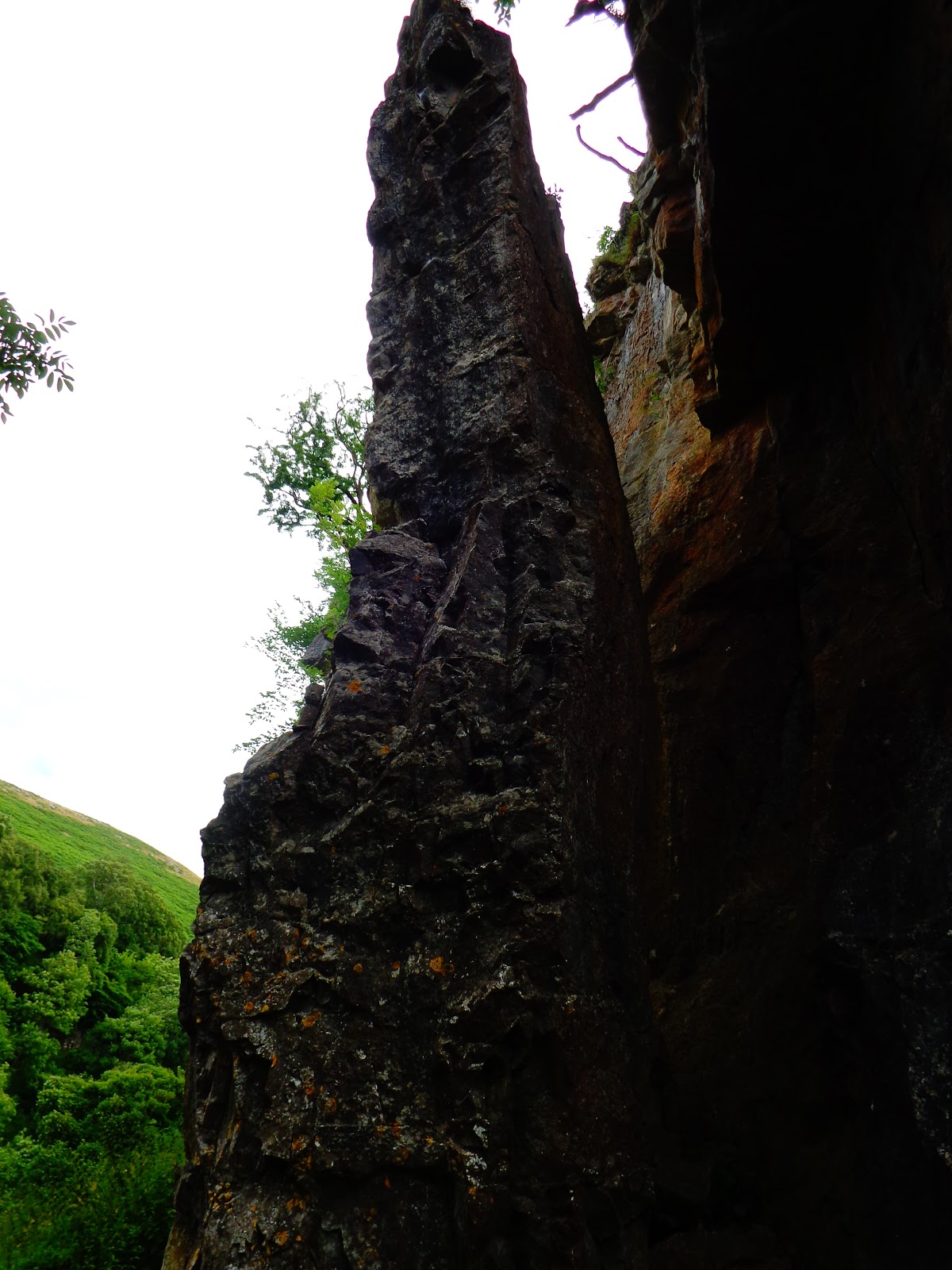
And so we took a right turn down to Kisdon Force, the first waterfall of the day. An interesting rock pinnacle. It’s a shame the camera darkened the overhead rock looming above us:
Kisdon Force …. Before the steep and muddy, rope assisted descent:

I was suddenly concerned that not everyone might fancy this so double checked that everyone was okay with giving the climb down a go …. crazy fools said they were. Shaun went first and made it look easy.
So, once we were all down relatively unscathed, here’s a few pics of the falls (waterfalls, that is).
Warren contemplating a quick swim. Looks like Ellie’s already been in though:
Fortunately, Peter found an easier way back up to the path again. I don’t think any of us cared that it was headed in the wrong direction. All I’ll say is, if any of you do decide to do this walk, DON’T take the path that is signed “Kisdon Force” unless you want to do a bit of rope/mud scrambling down. Retrace your steps about a quarter of a mile and find “the other” path …. Much easier route.
And onwards to Keld. Yep. That’s Keld in the distance. All in all, about 8 houses and a tea room:
…. It would be wrong not to:
The tea room also has a camp site. So we made use of the facilities before carrying on.
We headed off on a little detour in search of Catrake Force next. Didn’t find it, though I was convinced that if we’d continued “a bit further up the track” we would have done… we could hear it loud enough. It was discreetly pointed out to me that we were more likely to find it if we turned left once we’d crossed the river to pick up our route on the other side.
So, we toddled back from whence we came and picked up the Coast to Coast path for … oooh… about 50 feet:
We all agreed not to go looking for Catrake Force and, once over the bridge, we turned right instead. I detoured just before the bridge to get this great pic of everyone enjoying the views!:
But this is what they’re looking at. East Gill Force:
Much easier to get to this one and we spent quite a bit of time here:
Ellie – “I got me a stick, it’s my stick”:
Ellie – “bloomin’ ‘eck, it’s freezing in there…. where’s me stick? …. and who can I stand next to to shake all this water off me?”
I decided to go for a little paddle too.
Lovvverryly!
Then we headed out towards Crackpot Hall. There seemed to be a War Of The GPS going on between Peter and Shaun. Peter’s said we’d had 3 hours of “not walking” which, in all honesty, was probably true!; whilst Shaun’s was telling us we’d climbed about 3,000ft… not so sure about that but the route so far was very uppy and downy, and there was more to come as we headed along the edge of Hall Out Pasture:
This pic brings on a whole new meaning to Shaun (shorn) The Sheep:
Warren calling for Ellie who had discovered a new and more interesting hobby than “Where’s Me Stick”…… “Chasing Wwwwwwabbbbits” (though she’d probably lick it to death if she caught one):
As we meandered along, yet another gorgeous view was threatening to appear.
But before it did, we had a bit of a discussion about which path to take. The instructions were telling us to take the path left but everyone’s GPS routes were telling us to continue along the path right. Fortunately, someone called Sam was having the same problem:
After a quick rearrangement of the stones, the instructions were proved correct and that we were to take the path left towards the rusting tractor!!:
I got a brand new combine ‘arvester and I’ll give you the key. Shaun, you really need to get a new car:
(note that Peter, Gill and Warren… and even Ellie… are edging away nervously so as not to be associated with us).
Oh, oh, oh… that gorgeous view has come into view. Looking down the Swale valley between Black Hill on the left and Kisdon Hill on the right:
Crackpot Hall. There’s some (not going to mention any names) would say I live here. Indeed, I’d love to with that view:
“In need of modernisation and decoration” I think sums it up. Whatever it once was, there used to be two floors to it – this is the top floor, the lower floor is cut into the side of the hill and, well, let’s just say… sheep use it.
This is “The Big House” set higher up. Now this, you could do something with:
Nah, you’d hate to look out every morning on a view like this:
…. with it’s tantalising glimpse of the riverside path back to Muker. Buuuuuut, we don’t want to head down there just yet.
We want to clamber up along the rocky path of Buzzard Scar:
Before descending down Swinner Gill:
Couldn’t resist this sneaky pic looking back towards the River Swale from what felt like the edge of the world. Stunning J:
A lovely heather-clad view of the waterfall at Swinner Gill:
This is about as near to this one as we get though. There were a few questions asked when I said we were turning hard right to zig (well, actually, it’s a zag – zigs go left) back down the side of the same hill instead of crossing over to take the path on the opposite side.
I’d have quite fancied an explore of the Lead Mine to it’s left though… and maybe another little paddle, but, by now, I was aware we’d been out literally all day and as “someone” (that would be everyone but me then!) pointed out, it’s the longest they’d ever spent doing a 7 mile walk and there was a frantic consulting of GPS devices to gather some stats.
And so onto the final leg down into the valley:
Passing an interesting looking bottomless pool:
A final tea break. It was pretty blustery round here and Gill (now high on coffee) suggested that “what this place needed was a wind farm”.
Oh, yes, we were perched on the edge of a pretty steep hill. Perfick J:
Sooner or later we must drop down to the river:
Aha, yes we do. After a fairly steep final descent we make it to the river.
Peter looking mighty pleased with himself:
And so we encountered some inquisitive cattle. Ellie was on her lead by now and Mum Cow was fairly non-plussed. It really does work letting your dog off the leash because as soon as Ellie ran free, the cows lost interest and just stood and watched us plod past.
They were probably thinking “you’ve spent HOW long walking 7 miles?”:
A final glimpse of the blue sky on the river before the rain descended on us again:
On with the waterproofs for the final bit back into Muker. I wanna go back up into the hills – it was sunny up there:
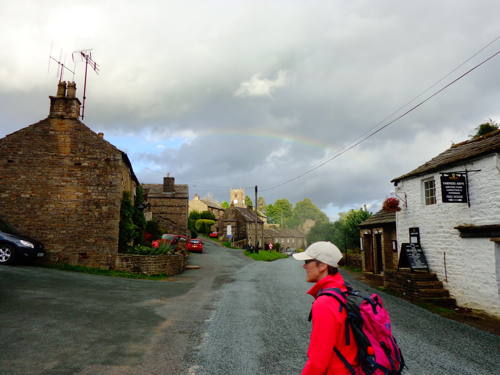
Back in Muker now, glad we missed the worst of the weather!!
A faint glimmer of a rainbow above the Church:
(note the sign for the pub on the white building. Gill knows where she’s heading.)
I think post-walk pub stops should become mandatory:
All in all, an absolutely brilliant day in great company. It was good to meet everyone, and some for the second time. I’m sure if I’d walked this alone I’d have enjoyed it …. but not half as much.
And the walk was exactly what it said on the tin “Swaledale Saunter – a leisurely stroll”…. Not ‘arf !!!!
The whole walk, including our little diversions and wanderings turned out to be 8.5 miles with a total of about 2,000ft of ascent and took us about 10 hours (including our cuppa and snack stops and all those “oh, wow, look at that” moments)!!!
And just for fun, a map of Ellie’s “DogNav” route: