Sunday, 12th January 2014
There's not many pictures because I was actually concentrating and learning things, so grab a cuppa and read on....
Having only ever met Kev in the fog and the dark (Pen-y-Ghent Night Time Nutters walk), I thought it would be nice to meet him in daylight. So, when he posted that he’d passed his Mountain Rescue night navigation assessment and asked if anyone wanted to brush up on their skills and help him practice his, I jumped at the chance.
A month later found us meeting in Kildale at the top end of the North Yorkshire Moors. He had to describe his vehicle to me because I sure as hell couldn’t remember what he looked like…. A shadowy figure with a flipping great big… head torch ….. was all I could remember

Anyways, I found him, also met Bastad the dog (can’t actually remember his real name but he answered alright to this), and we did a peculiar car/van shuffle – my car apparently would get up this tiny little track better than his van. We took a short detour via Kildale Station (or rather the toilets there)…. Or should I say we took a detour PAST Kildale Station/toilets and ended up in a farmer’s yard.
This did not bode well for the navigation practice

We eventually wound our way up this tiny, steep little track/road… behind a cyclist. Possibly the first time I’ve driven any distance in first gear. Both of us pulled in to let a giant roll of hay drive past then the cyclist waited for me to go first. I got the filthiest of looks off him as I (unintentionally) wheel-spun on the frozen mud/ice as I tried to set off again.
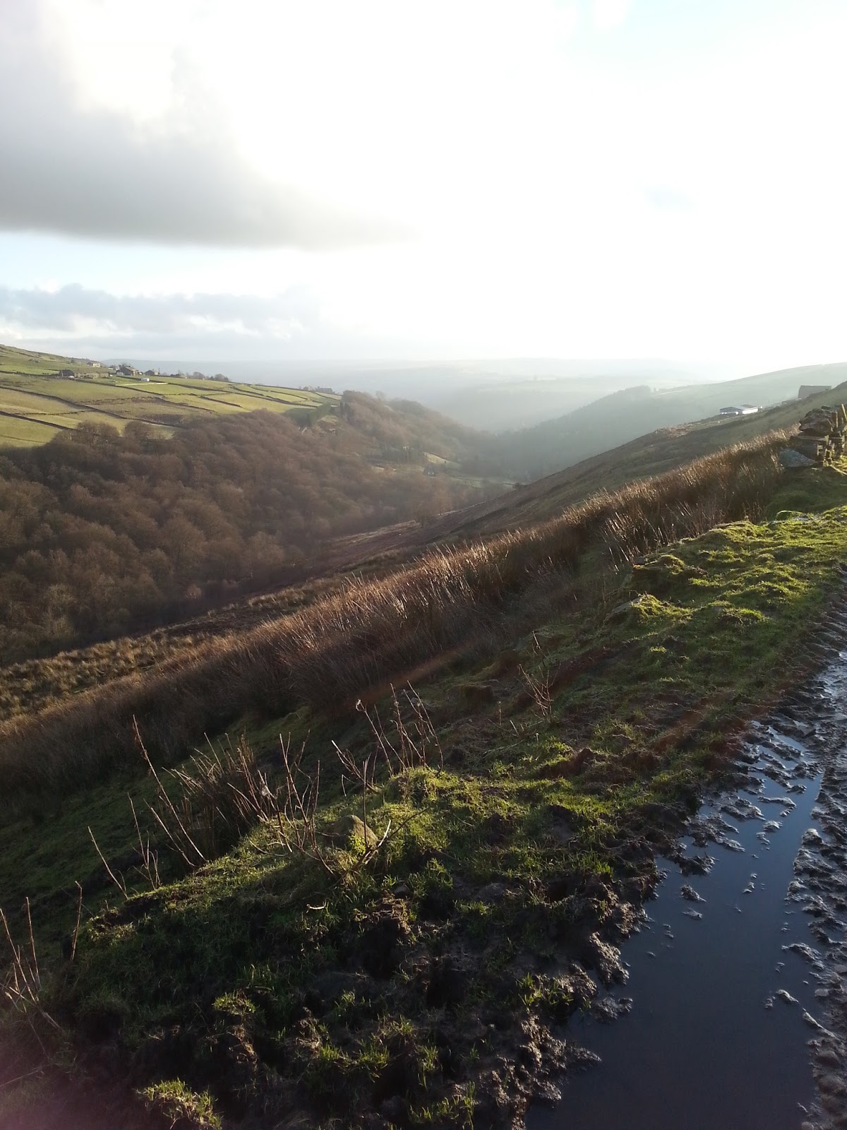
Aaaanyway, we got parked up and boots on and straight up a forest track. A quick discussion about what sort of level I was at navigation-wise then he had me counting my paces. Fellas, this is a great way to shut your women up

So I do 67 paces to his 62. I still wasn’t fully understanding the importance of knowing how many paces you take over 100 metres, nor was I properly understanding the whole Romer Scale thing either. But I thought it best I kept my gob shut and hope it made sense at some point

So we studied the map and “paced” to a junction. I got this big daft grin on my face when I realised a few steps before that we were going to get to that junction bang on my 67 paces. I genuinely was amazed at how accurate that was. There was a glimmer of understanding sparking in my brain cell.
We carried on along the track which opened out onto some sandstone steps – heading up to Captain Cook’s Monument. They were a bit slippy with frozen puddles but we got to the top okay…. And was greeted by a bitingly cold wind. My gloves made hasty exit out of my nice warm pockets and the fleece/softshell/jacket was hastily zipped back up again.
I had a quick study of where I went wrong last time I was up here – it seems so obvious now – and we headed down the path towards Gribdale Gate:
Yes, those are Christmas decorations on that tree

At Gribdale Gate Kev informed me that I would be navigating from now on

and showed me the track on the map we was to take. Fortunately it was really obvious on the ground and off we set. Pacing in sets of 100 metres to various bends on the track…. And then… then we went off-piste, heading towards a mound of earth with a stone in it. And by ‘eck, we bluddi well found it

From there, we headed to an enclosure. Quite a way away that was, and halfway along, I think Kev spoke to me and I lost track counting my paces. Not to worry, still head in the same direction. I thought he was having a larrrrf when he kept saying what can you see directly in your line of sight in the direction you’re heading? Errm, heather, some dead marsh reed things, more heather, oh, a grouse, some heather? Whaddya mean head for that little bump of heather with two reeds sticking out of it

It started to dawn on me that, although we might only be moving forwards about 10 foot at a time, we were heading in a dead straight line.
I got brave and aimed for a bump of heather 20foot away. And so we plodded until….. we got there! This enclosure was obvious once you was “on top of it” but really, it was nowt more than a shallow trench in the ground. Things were starting to make sense in my brain cell now and Kev explained that if we were walking here in the dark, or mist, we would have no choice but to do exactly what we had just done – aim literally for a blade of grass in our line of sight… and then the next one…. and the next one, until we got to our “target”.
Our next objective. Lunch stop in a quarry. Feeling really brave now, I got a patch of different coloured hill in the distance in my line of sight and off we went, despite the “are you sure you can’t see anything closer” look off Kev. Poor Bastad was boing-ing along, ears flapping, and getting all tangled up in the dead reed/grasses – he’s only got short legs bless him

I found out why I got that “look” as we reached the sheer drop of the quarry edge. Fortunately, we’d been pacing so I knew it was coming up… but in the dark… well, I wouldn’t have been able to see that different coloured patch of hill in the distance in the first place but, yeah, lesson learned – watch your footing as well as keep an eye on where you're headed as well as keep track of how many steps you’ve taken. Ooof, my brain hurts

Now, Kev, he'd have us believe he hates his dog but, once we’d got down into the quarry, he heard a “yelp”. Now I knew it was the sound of me loosening a strap on my rucksack but, the look on his face as he raced off to find Bastad said it all – he loves that dog really

Anyway, Bastad came bouncing down the quarry face in the opposite direction, completely unharmed and went off in search of Kev
who hurriedly pretended that his attempt to lose the dog had failed

We found a comfy quarry stone and had our lunch break in relative shelter from the chilly wind. A few charred tree branches told us that folks had probably wild-camped here and Kev told a chilling story of a woman who lost her horse in a bog at the bottom of a quarry
I scanned the floor nervously. Even Bastad decided to sit on a stone in safety:
Suitably fed and watered we climbed back up out of the quarry and set off towards our next target – the point where a little stream meets a track. This is where I learned about “aiming off” so compass set and we headed for a point on the path slightly to the left of the stream. Now, as luck would have it, there was a fairly narrow, but obvious path headed in the same direction so I decided to follow this, making sure we were still heading in the generally right direction. The dip to our right and the gurgle and tinkling of water indicated the stream was there somewhere to our right so all was good. We got to the track and turned right. Hey presto! The stream less than 10 feet away
Next task, aim for another track. We didn’t find it – and we should have literally crossed over it. So we carried on towards another track which wasn’t there either. These were public rights of way so you’d have thought there would be something, but no. Nowt, nothing. Yet studying our route once I’d got back home confirmed we did, indeed, cross both tracks, pretty much on target. So we headed for the very obvious Cleveland Way and a stand of trees on the other side of a wall…. And then to pinpoint exactly where we were on the map…. Just after the edge of the trees and just before a left bend in the path. Aha, there we were. And if we were correct, on the bend there should be a boundary stone and a pool of water to our right. Sorted. Spot on
We were now aiming for a track off to our right a few hundred metres away. I was warned it was easy to miss. And indeed it was. I aimed short (67 is such a hard number to divide in half!) and idly noticed a “dogs on lead” sign in the heather as we looked. We overshot the mark and Kev said it was near a dogs on lead sign. Oooooh, that was back there, maybe 20 feet away back there. If you looked into the middle-distance you could see the double track clearly beyond the sign, but until then, it was hidden. More heather-hopping (gosh my boots were the cleanest they’ve been for ages!).
Kev heading back to me after retrieving Bastad off the Cleveland Way:
Frozen puddles:
Our final off-piste target was a burial mound (pile of stones to you and me) slightly off this track which meandered and wiggled across the moors:
Was it over there?:
Nope.
I reckon it's over there somewhere:
More pacing and we stopped slightly short of where it should be. Nope. Not seeing it. I aimed for a white thing which turned out to be a plastic bag and Kev wandered up this heather clad lump on the ground. Doh, a burial mound perhaps?
Sure enough, there was a pile of stones in the middle of it:
It’s amazing how near you can be to something and not “see” it.
Next task. Aim for a junction of paths on the Cleveland Way again. More aiming off as we headed slightly to the left of this junction. I turned into a wimp when I wouldn’t cross the drainage ditch onto the Cleveland Way and did an inelegant bottom-slide into it and equally inelegant step out of it. We turned right and in a few feet, there was the junction:
But we carried on, leaving the Cleveland Way to follow a clear track South-East. At some point along this track I decided I wanted to try and guess exactly where we were on it. Map out and, oh, there’s Captain Cook’s monument to our right, and Highcliff Nab to our left. Scouring the map we were about halfway between where we joined the track and a Tumulus at a junction of paths and tracks…. And hopefully, we’d be passing a boundary stone fairly soon. We did. Then we passed another one. Good good. All helping me to know exactly where we were. No it didn’t really matter at this point but it was nice to know
A little further on and we got to the Tumulus. An Iron Age enclosure which, in reality, was nothing more than a patch of fenced off heather with this in it:
Bastad went in to explore though and we carried on along what was now a road called Percy Cross Rigg:
More pacing but then we got gabbing so just looked out for a track off to our right. Oh, well, it wasn’t the one that said “Private Property – No access” but it was the one further up, a ways before a bend in the road and the brow of a hill. Yeah, we’ll go for that one
As we headed down and through the trees on a pine-needle strewn track, the biting wind finally disappeared and it felt positively balmy in comparison. The frozen puddles told a different story though.
Another little rest stop over the railway track near a stream with a convenient wall to sit on before carrying on down the road and back into Kildale again and to Kev’s van. Sadly, my car was still parked at the top of that nice, steep hill I drove up in in first gear

I had a slight cause for concern at this point as Kev opened the back doors of his van and said “right, lets get you chained up in here then”
…. then I realised he was talking to Bastad…. at least…. I think he was

Fortunately I didn’t have to walk up that hill cos I got a lift to my car in the van – and no, I wasn’t chained up in the back
… A quick note about my journey out of Kildale….. I drove down the steep hill and couldn’t for the life of me remember if I should turn left or right at the end. It took Kev in his van behind me to start indicating to give me a clue. After spending all day successfully finding random piles of stones scattered across the moors and I couldn’t even find my way to the main road
A big thanks must go to Kev (and Bastad) for a brilliant day’s walking and nav practice. I feel like I’ve learned loads
and I’m itching to practice it to see if it’s really sunk into my brain cell or if it was just beginner’s luck.
(he loves that liddle dawg really

)
Seeing as I'm adding this entry some 4 years after the event, there's no ViewRanger track recording as I didn't discover VR until the April.
Thanks for reading