Tuesday, 10th July 2018
Another scorchio day.
My original plan was to complete my walk up to High Tove from Armboth - the Thirlmire side of the hill but, Anglian Water have decided to close the roads and permissive paths due to "falling trees" on the western side of the reservoir. Bit miffed.
Anyway, I ended up driving down the Borrowdale valley and up the scary and narrow road to Watendlath (never again!), got parked up at the National Trust car park and set off. No option of a gentle warm up start to the walk from here.
 |
| Start of the walk - about 50 feet of flat before the uphill starts |
Straight up the side of the fell

Luckily, it was rough paved which made the going a little easier, but it was steeeeeep. The sun was beating down and there was no wind. I soon began to flag and used every zig and zag in the path to admire the views at length which were opening out behind me. I have to confess, I struggled - mainly due to the heat - and I got through my water pretty quickly.
 |
| Looking down on Watendlath Tarn |
I took it slow and steady and eventually reached the tree line where I was met by an interesting sign:
So that explains that then.
I was hoping there might have been a bit of water in Raise Gill so I could top up my water bottles but no, it was bone dry:
 |
| Raise Gill - bone dry |
Beyond the gill, the terrain looked much like this:
 |
| Grassy uphill all the way |
I spotted a bit of heather just starting to bloom. NooooooooOOOooooooo.... despite the prolonged spell of hot/sunny weather, I'm not ready for signs of the end of summer yet

 |
| Clump of Heather |
This normally boggy, squelchy fell was bone dry. In places, it was quite obvious where some of the deeper bogs would have been knee deep:
 |
| A totally dry bog |
 |
| Dried out Sphagnum Moss |
 |
| Baked dry |
Eventually, I reached the top:
 |
| Summit Cairn with the Helvellyn range behind |
 |
| Blencathra |
 |
| Pano shot of the western fells |
I took a couple of pano-vids from the summit:
Despite a lengthy summit slug lunch stop of sarnie, cuppa and bun, plus a good rest to digest it all, I still didn't feel very ..... energetic .... and decided to sack off my idea of bagging Ullscarf in favour of returning the way I came and getting into some shade and back to my car for a drink of water. My carried supply was being rationed now and I wasn't feeling ... can't put my finger on it ... it wasn't unfit, it wasn't tired ... just, well, probably simply too hot. This featureless fell has absolutely no respite from the sun.
 |
| Looks like rain |
 |
| I think the lake in the middle distance is Bassenthwaite Lake |
As I descended I noticed a purple haze over High Seat - patches of heather:
 |
| High Seat with a faint purple haze covering its flanks |
 |
| The fabulously named Jopplety How on Grange Fell |
I have to admit, the views on the descent were pretty spectacular but, because I was walking into the sun, the photos didn't turn out too good.
 |
| Ooooh, water! |
I returned again to the dry Raise Gill. There were Sandmartins nesting in the banks and they flitted around nervously as I walked above their burrow/nests.
 |
| Move along folks - still no water here |
 |
| Watendlath Tarn coming into view again |
 |
| Harebell |
 |
| Cottongrass and some strange orange things |
 |
| An Orchid of some sort |
 |
| Blurry picture of an almost gone to seed foxglove |
 |
| A paddle here would have been lovely! |
 |
| Info Board |
I returned to my car and glugged down most of the bottle of water I had in there. Luckily, I'd parked under a tree and the water (and inside of my car) wasn't boiling hot.
I stood and read the info board before setting off back down the narrow, single track road.
On my way back I stopped off at Surprise View:
 |
| View from Surprise View - Derwent Water and Bassenthwaite Lake beyond |
There was a photographer sat here with his camera all set up. I asked him if he was doing a time-lapse but he didn't speak very much English and answered that "it is very hot today" in a thick, possibly Polish, accent.
 |
| Brambles! |
Further down the road I reached Ashness Bridge. The hoards of people had gone now and I had the bridge to myself.
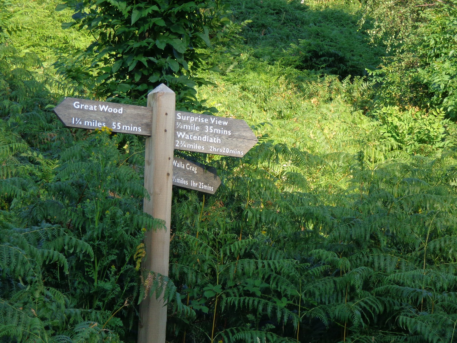
 |
| Signpost OCD |
 |
| Ashness Bridge |
I returned back to the caravan for a lovely shower and Chicken Tikka Masala for my tea.
Despite the walk only being a couple of miles long, I found it really difficult due to the heat. I'm just not feeling on top form generally at the moment and I'm finding that really frustrating. Bring on some cooler weather!
Thanks for looking


