Search This Blog

Pages

Derbyshire - Froggatt, Curbar and White Edges (6.4 miles)

Sunday, 27th October 2019


Met up with Ed for another forum meet in the Peak District.

Travelling there this time was blissfully uneventful and I arrived at the layby, snaffling the last parking spot.

I had a leisurely faff about, eating my breakfast (an apple), getting my phone GPS cranked up and my walking shoes on.  It got to about 10.10am and I decided that Ed was unable to make it after all so I set off down the road.

Just before turning off the lane to the National Trust car park I heard someone calling my name and turned to see Ed waving.  So I pootled back up the road to him.

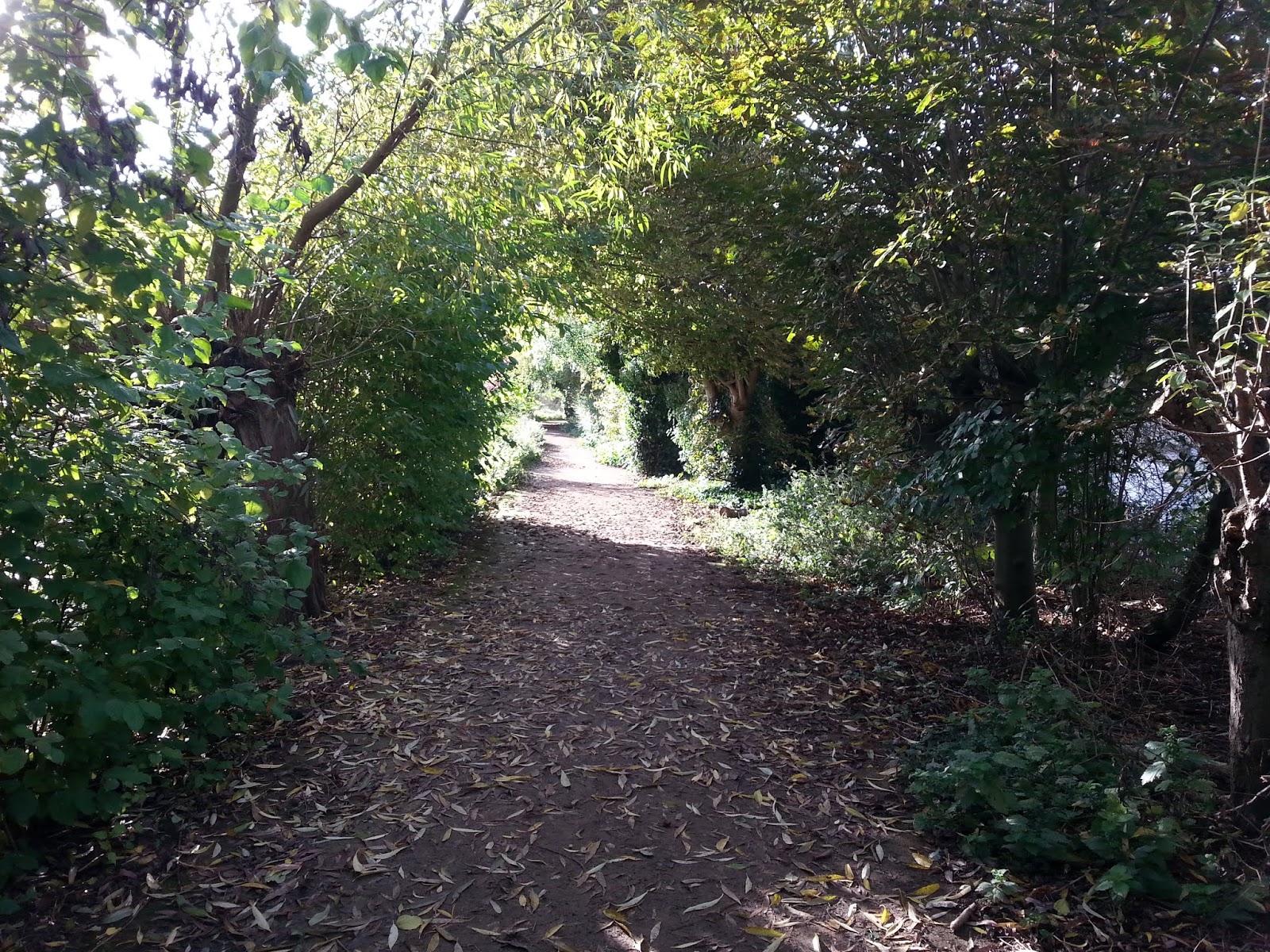
We got set off (back down the way I’d just walked) and headed through the woodland to the stream.  There was plenty of water in it and I was ever so slightly apprehensive about crossing it via the bouldery rocks as my balance isn’t that great.  Ed led the way and I inelegantly  clambered across after him.

Obstacle navigated, it was a short, stiff climb away from the stream and up to the road, which we crossed and headed through a gate and onto the beginnings of Froggatt Edge.

Before long, we spotted our first rocky outcrop:


Somewhere along the path there is a stone circle and we were given some duff information by a couple walking past.  It wasn’t there and we forged a squishy path through some scrubbly woodland before returning to the main path again.  Eagle-eyed Ed spotted it in the end (he has a pic).

Views kept appearing through the trees across the Derwent Valley:


Eventually we got onto Froggatt Edge “proper” and followed the “motorway” for a while, occasionally taking the time to dip in and out of the rocky outcrops and ledges:


I took a snap of the view up onto White Edge – there were hordes of people walking along it and I voiced my doubts about seeing any deer/stags with that many people about:


We arrived at Jolly’s Tea Van at Curbar Gap car park where Ed partook of a coffee and I had a bag of crisps - to fortify ourselves for the stiffest climb of the day up onto White Edge.

Leaving the car park we headed East onto a farm track.  A nice sign pointed us in the right direction:


... and spotted this:

A bit of poetry carved into a slab of stone. Sometimes poetry is very strange 

I was relieved to see that the worst part of the climb up onto White Edge had been paved – the last time I was here it was just a slippery, grassy trod and, given the rain we’ve had recently, I was expecting it to be a mudbath/swamp/skating rink and anticipated having to do a little contour line traversing to avoid it.

The start was still a little muddy but nothing un-navigable, with a nice little stone bridge over the stream.  I checked for trolls but none were found: 

After the initial stiff climb, it returns to the more gentle gradient I was comfortable with and Eagle-eyed Ed spotted a herd of deer away in the distance  (he has pics).

After that, it wasn’t long before the trig pillar came into view:


Or, rather, it would have come into view if it hadn’t been photobombed by a dog!

I touched the top, at 365m above sea level, this is the highest I’ve been in a looooooong while and .It .Felt .Goooooood 

The views were fantastic.  Autumnal moorland topped with bright blue skies and fluffy clouds – perfect:


I was disappointed, but not surprised that there weren’t masses of stags burbling and rutting everywhere but there were still plenty of people around which was probably making them keep well away and pretty much out of sight.

However, we did spot a few bachelor stags away off in the distance and a few does hidden in the moorland and it was only by using the zoom function on the camera that we could confirm they weren’t rocks!  The zoom photographs I took were absolutely pants. 

It was about time for a snack stop and I spotted a large rocky outcrop a little off the beaten track to sit behind, out of the wind, with good views over Big Moor (and hopefully stags).  It can’t have been the same place I stopped at before as I don’t remember finding a smashing little stone shelter with seats, which is what we ended up sitting in.  Quite pleasant out of the wind it was.

See if you can spot the stags:


After quite a leisurely snack stop we rejoined the blustery path.  I’m not sure if it was because we’d changed direction slightly or what but the wind seemed stronger (and colder) than before.

The path along White Edge is lovely.  Nice and rough and ready with rocky bits and peaty bits and sandy/gritty bits and has a much more wild feeling that Froggatt and Curbar Edges.  After negotiating a couple of impromptu streams gurgling up and out of the moorland and off down the hillside we spotted some more stags and does to our left this time: 


We stood a while and watched one particular stag who obviously fancied his chances with the ladies but his Chosen One was having none of it 

From there, it was an interesting gentle uppy and downy ridge-walk:


…. to the Hurkling Stone:


No, this isn’t the Hurkling Stone that’s on the more familiar Derwent Edge and I’m not convinced that the definition of “crouching” means much of anything at all.  Both (that I’m aware of) are on the end of a long ridge and I wonder if they’re more a precursor to a modern day cairn – a visual signal of the end of a ridge.  Anyway, I digress.

At the wall just beyond, we took a left turn down to follow it back to our cars.  Shortly after commenting to Ed that I remembered it being steeper and rocker than “this”, the steep and rocky bit appeared and, again, I turned into a wuss at climbing down – despite it only being, oooh, what….. 10 feet of horribleness.  I’d have been fine going up it mindst.

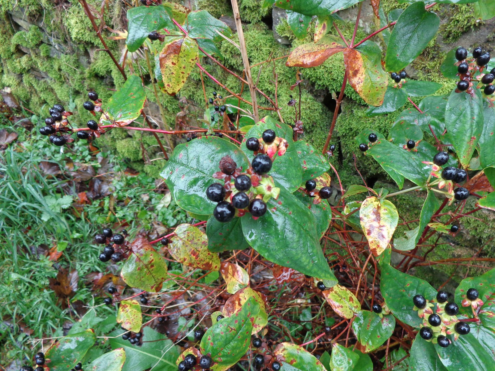
From there we entered a lovely little patch of woodland:


Before squelching across a rather waterlogged field and back to the cars:


All in all, a right grand autumnal day out, despite not being overrun with rutting, burbling stags 

Finally, here’s a computerified zoom in of a zoom in of a stag:


I need a better camera.

This is the second "proper walk" I've done where I've had absolutely no tendon issues whatsoever.  I'm quietly hopeful that a combination of walking shoes, losing a bit of weight, yoga and regular but shorter walks at a leisurely pace has contributed to its improvement.  Fingers crossed eh?


Parking: Layby nearest The Grouse Inn (free)
Distance: 6.4 miles
Max height: 1,216 ft

Thanks for looking 


East Yorkshire: Beverley Beck (3.75 miles)

Thursday, 17th October 2019

After doing a half day at work on Tuesday I only needed to do a half day today so I made the most of the brief autumnal sunshine and the fact I was already in Beverley to do a semi-urban walk along Beverley Beck.

I left work, grabbed a sarnie from my favourite deli and headed off through the streets of Beverley for a nice little mooch.

Some pics:


After sitting and eating my sandwich on a bench overlooking the boats (and the submarine!) I crossed the lock to walk back down the other side of the beck.


Eventually, I turned off down a little 10-foot between some houses (it was more like a 4-foot) and popped out near St Nicholas Church. 


From here it was a short mooch through some landscaped woodland gardens and back to the station.

To be honest, I got the best of the weather because as I drove home it went all overcast and started spit-spotting with rain.

Just time for a cuppa before turning out for job number 2!

I'll sleep well tonight!!!

Parking: At work
Distance: 3.75 miles
Max height: 39 ft

Thanks for looking 😊

COUNTY BAGGING: Derbyshire - Ladybower Reservoir (9 miles)

Sunday, 13th October 2019


After a horrendous drive due to torrential rain (localised flooding) and road closures/diversions at Myton Bridge I set off to meet up with a couple of people off the forum for the first forum meet for a while that I've been able to go to.

After being stuck in traffic at Myton Bridge, at last, I was on my way.  Driving conditions were grim with standing water on the A63 and the road spray plus the rain making visibility practically zero..  Then I turned my wipers on…

SatNav took me via Rotherham and Sheffield (which was nice) and I finally found a spot to pull over and text Rich to let him know I was running late.

Scoffing the banana part of my breakfast as I pootled down the A57 and arrived at the car park to see 3 soggy figures stood forlornly in the rain.  I leapt out of the car, apologised profusely for being late, phart-arressed about a bit, got my feet on and finally, we were off.

Oooh, the views.  Despite the mizzle and murk to see hills, cloaked in autumnal colours, tis a wonderful thing.  I think I managed about 100 metres before I had to stop and take a photo!


View along Ladybower Reservoir towards Win Hill

We got halfway across the second bridge when I, having been convinced I’ve walked “around here” before, asked “what’s that hill there?” pointing at what I now know was Bamford Edge.  Rich  obligingly unravelled his map from its case to inform me of this.  There then followed a quick lesson in map origami as the pressure was on for him to get it all folded back up to how it was with 3 pairs of beady eyes watching.  You wouldn’t have this problem with an electronic map….

Eventually, we got off the road and onto the permissive path on the western side of the upper “prong” of the reservoir.

Time for a group photo:


Rich, Rob and Ed on the Ladybower Permissive Path
Hot topic number one – fitness and age.  Somehow this ended up with Rob taking a guess at my age.  He is now my New Best Friend.  Rich left it about 3 seconds before bursting my youngness bubble by piping up with “that’s right, it’s always good to guess well below what you really think”.  Yeah, thanks for that.  Ed (sensibly) kept quiet.

So, with Rich on the Naughty Step we continued along the mud track.  And then, a voice piped up; “one point four seven” (or something) it said, randomly, out of nowhere.  Rob looked a bit sheepish and ‘fessed up it was his new watch talking to him.  There followed a “hard sell” sales pitch as he tried to flog me his old fitbit type thingy.

Hot topic number two – which forum members have you met.  I was quite surprised when names (past and present) kept popping up and I was “yes, I met them on such and such a meet”.  Thinking about this later, I’m quite surprised at how many folks off the forum I have met – all thanks to forum meets.

We kept spotting “green things” half buried in the ground:


Reservoir Valve housings
Hot topic number three – what are they?  The writing on them said “DVWB” which we decided stood for “Derwent Valley Water Board” and similarly decided they were “something” to do with the reservoir.  Hey, there’s nowt gets past us you know!

We wandered through lovely, leafy woodland sporting some fine autumnal colours:


Lovely woodland path sporting autumnal colours
… and had a bit of a discussion of how grim it would be “up there” (the Hurkling Stones on Derwent Edge) in today’s weather:


Hurkling Stones on Derwent Edge
Apologies for the splodges in the pic, I guess my camera lens still isn’t fully clear of the Shacklesborough Sheep Poo.

Arty-farty pic:


Arty-farty pic of autumnal colours across the reservoir
After negotiating the hardest part of the walk – the steps down and up near the aqueduct – we arrived at Fairholmes where the option for a comfort break and cuppa was declined by all.

Hot topic number four – an activity which involves cars, parked, in lay-bys.  Ed took the lead on this conversation and knowledgably updated us with what interior light, headlamp or indicator setting meant what.  Oooh, Eddles, you durrrrty dawwwg.

As we headed around the corner we were confronted with this.  Derwent Dam:


Derwent Dam in full flow
Wow.  It was in full flow and just….wow.

I stepped off the righteous path to go and have a closer look and, just, Wow (with a capital wubble-yoo).

Some pics:


Pano shot

Useful instructions!
The Three Amigos were stood patiently waiting for me:


The Three Amigos patiently waiting
Easy quiet lane walking now:


Private (vehicles) lane
Looking across the reservoir to the side we’d just walked:


Looking back towards the aqueduct
Hot topic number five – flora and fauna.  We kept spotting these small, dark purple berries.  I wondered if they were blackcurrants or something:


Dogwood
… so I ate one.  No, they’re not.  And I’m still alive.

Herein started a berry-nibbling session.  Everything we passed, we nibbled on and discussed the correct way to identify if something is poisonous or not, apparently a procedure none of us were following.  We didn’t nibble on the Yew berries though.

We wandered past and eeee-nORmous bracket fungi and I can’t believe I didn’t get a photo of it.

We also wandered past the “Effluent Sampling Point”.  Although we were sampling the fruits of Mother Nature’s labour, we decided against taking up the kind offer.

It was about time for a snack stop and The Law of Sod came into play.  Not a suitable place to sit was to be found.  The only bench we spotted was occupied by other people.  How dare they!  Anyway, we loitered long enough, taking photographs and reading the info board (and discussing Hot topic number 6 – what the area looked like before it was flooded) for them to feel uncomfortable and move on.  Excellent.  Not only did we have a nice seat to sit on but they’d dried it off too. 

Our lunch stop view:


Atmospheric view along the reservoir

Info Board
From here it was a relatively short walk back to the road and, soon enough, one of the bridges came into view:


Mist swirling on the hills above and 2 men fishing in a boat
Some nice mossy stones on the hillside (me likey mossy stones):


Mossy rocks
Once back at the road we retraced our steps to the car park, but not before me sampling a bright red berry of some sort.  Eeeeeauuuch, ye gods it was sour.  I’m still alive.  After googling “sour red berries” it came back with Cranberry?

And then our detour to see the plugholes.  Rob thought we were pulling his leg when we said we were going to see the plughole in the reservoir!:


Plughole

Short video of the plughole in action:

As we returned to our cars it was time to check the mileage.  Posted as a 6ish mile walk we were all gobsmacked to find we’d actually walked 9 miles.  At first, Rob thought his new talking wrist gadget thingumabob maybe needed calibrating but my dedicated GPS phone with ViewRanger app is pretty accurate and confirmed it was 9 miles.

I certainly didn’t feel like I’d walked 9 miles, that’s for sure and I feel quite chuffed with my little self for doing so with no tendon ache whatsoever and only “normal” hip/thigh muscle fatigue.  We all agreed it must have been the good company and chat and chuckles that made the miles pass effortlessly.


Parking: Heatherdene Car Park (£3.00 for all day)
Distance: 8.93 miles
Max height: 799 ft


Thanks for looking 😊