Foreword:
One year on from my first foray up onto Catbells, and the total rigor-mortis that set in for about a week afterwards which was my introduction to hillwalking, I'd been training, practicing, to return someday and do the full round. Sooo.....
Plenty of walking later, and a couple of stone lighter, a navigation course in possibly the most hideous weather and terrain I’d ever walked in – 9 miles in rain, then in fog and about 3 miles of bog-hopping. After doing this and not actually suffering too much I decided I was ready to tackle Catbells again.
I booked the time off work, organised a cat-sitter, booked my accommodation, ordered some sunshine, gentle breezes and high white fluffy clouds, practiced my map/compass skills, did lots of walking in the with a rucksack far heavier than I would need, to compensate for the lack of steep, long drawn out hills round me.
The time had come...
Saturday 1st June 2013 - Castle Crag
I knew I’d arrive in the Lake District mid-afternoon – too early to book into my B&B for the weekend. So I had a little mooch up Castle Crag – a nice leg-stretch after the drive:
Castle Crag:

Stepping Stones - I didn't cross here though - knowing my luck I'd fall in and have soggy boots! :

Weird geological forces at play here :

My contribution to the rock art :

Me at the top:

On top of the Memorial - not a bad place really for a cuppa and a snack:

The steep, zig-zag path down!:

Sunday 2nd June 2013 - Catbells Revisited
Exactly a year to the day - the time had come. I managed to get the last parking space in exactly the same place as last year. I donned my boots and rucksack and off I went:
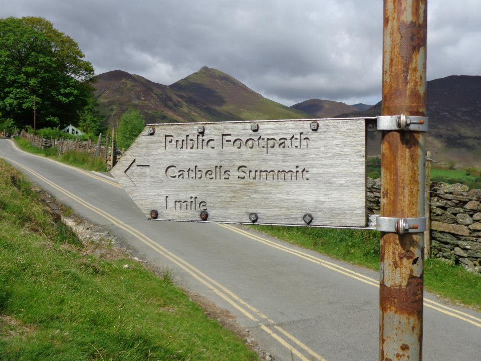
One mile eh? Is that all?:

The first of the many little scrambles :

Honestly, I only stopped half way up the second little scramble to take the picture ....honestly:

First glimpse of the Catbells summit :

Nearly there, not long now, just over this next hill:

Meeeeeeeee - at the top of Catbells :

On the way up I passed a chap coming the other way who commented about the café at the top. Having been up here before, I knew he was joking..... or not. These brave ladies had set up a tent on the top of Catbells and were selling cloudy lemonade and cake (which was delicious) to raise money for a Breast Cancer charity :

They did a roaring trade - the fell was busy. But hats off to them for hauling all that cloudy lemonade up there.
The first of many rather lengthy snack stops - ahhh, life could be worse :

Suitably fed and watered, it was onwards and, well, sort of down a bit then right a bit then up a bit to Maiden Moor :

I plodded on until these - I do believe these are part of Bull Crag - my nemesis:

Could I manage it this year?
You bet I could:

I believe this pic is of Blea Crag, protecting the flanks of High Spy:

As I wandered across Maiden Moor I noticed the weather had changed. The wind had got up and was whistling eerily through all the craggy bits - the mountain was singing to me and it was clouding over quite a bit.
I was on the lookout now for a cairn, a couple of pools of water and a left turn down the hill. I found the pools of water - this is the second one :

Not long now for the left turn I thought.... then I spotted this in the distance :

The cairn on top of High Spy. I started to doubt myself at this point. Was that insignificant pile of stones I passed earlier near the first pool of water the cairn at the top of Maiden Moor? I'd passed a few of those since then. Had I gone further than I thought? It would seem so - by my reckoning the cairn on top of High Spy was less than half a mile away from me... then again, it would seem my map-to-land reading skills still needed some work.
I wasn't particularly impressed by the weather in front of me and, not being familiar with weather patterns in hilly areas, I had to decide - do I turn back or do I sprint (well, plod) across to the cairn?
No brainer - Meeeeee, getting blown around a bit on top of High Spy. It were a bit blustery up there it were:

I did stop and have a celebratory cuppa and snack but it really did start getting misty and my thoughts (which had turned to carrying on down towards the general direction of Dalehead Tarn) changed into deciding to retrace my steps along what was a clear path and maybe go down that path I was looking for but never found. Don't forget, I was walking alone and I'm inexperienced with walking in this kind of terrain - had there been a few trees and field boundaries I'd have been more confident, but reading craggy contour lines isn't my strong point just yet.
But, I'm sure that's Skiddaw over there, and maybe Blencathra to the right:

I decided to take the stepped route down Hause Gate:

Now, don't be deceived there, that is a near vertical path down... and it goes down a loooooong way - pretty much straight down the side of the hill. I turned left before the path reached the road, to follow the lower flanks of the fell. Again, not my original plan - which was to walk through the woods and along the edge of Derwent Water back to the car but I was tired now (note - not exhausted) and I was conscious of the time. Perhaps all those leisurely cuppa and snack stops weren't such a good idea after all:
Then again....

Aww, and I saw this bold little chap singing his beak off:

Ahaaa! The cattle grid. My car's parked about 20ft to the left of it :

So, back to the B&B and a rather large celebratory glass of wine .... or four
The next day, my legs only ached pleasantly rather than feeling as if rigor-mortis had set in and I spent longer than I meant to wandering around Keswick and getting drenched on a boat ride on Derwent Water before setting off home. I'd been up the top, so now I went round the bottom:

Then had a rather delicious curly sausage and onion sarnie and a cuppa before my journey home. This sign outside made me chuckle:

But I did it! And I found it … sort of easy. Granted the 8 mile round trip took me about 9 hours, but that did include several very leisurely cuppa and snack stops along the way – after all, I wanted to imprint that lovely scenery onto my retinas.
Thanks for reading 😊