Sunday, 20th April 2014
I met up with Peter off the forum for a walk up Gragareth (627 metres / 2,060 ft) which, technically, is half in Lancashire and half in Yorkshire.
We parked up on the Lancashire side of the hill and followed a farm track north-ish for as long as we were able before zig-zagging off-piste to the trig point on the top.
From there, we continued more directly downhill to have a look-see what the "Three Men of Gragareth" was all about. Turns out it's a pile of 3 "cairns" lined up together, along with another 2 nearby and one stood alone a little further along. From there we simply descended the rest of the hill to the car.
It was a pretty blustery day and we decided not to do the full Leck Fell horseshoe so returned to the car and drove to Ingleton for a failed attempt at Ingleborough. The wind was far worse there and whipping up the sandy soil quite painfully.
Some pictures:
 |
| The lonely Leck Fell road with Gragareth on the horizon |
 |
| Looking towards Dentdale |
 |
| Peter and me at Gragareth's Trig point |
 |
| The rocky terrain near Gragareth's summit |
 |
| Peter heading to the first two cairns |
 |
The "Three Men" of Gragareth
with further cairns in the distance |
Seeing as it was such a lovely day, after returning to my accommodation, I decided to go for a short evening stroll in Malham along Janet's Foss to Goredale Scar.
Some pictures:
 |
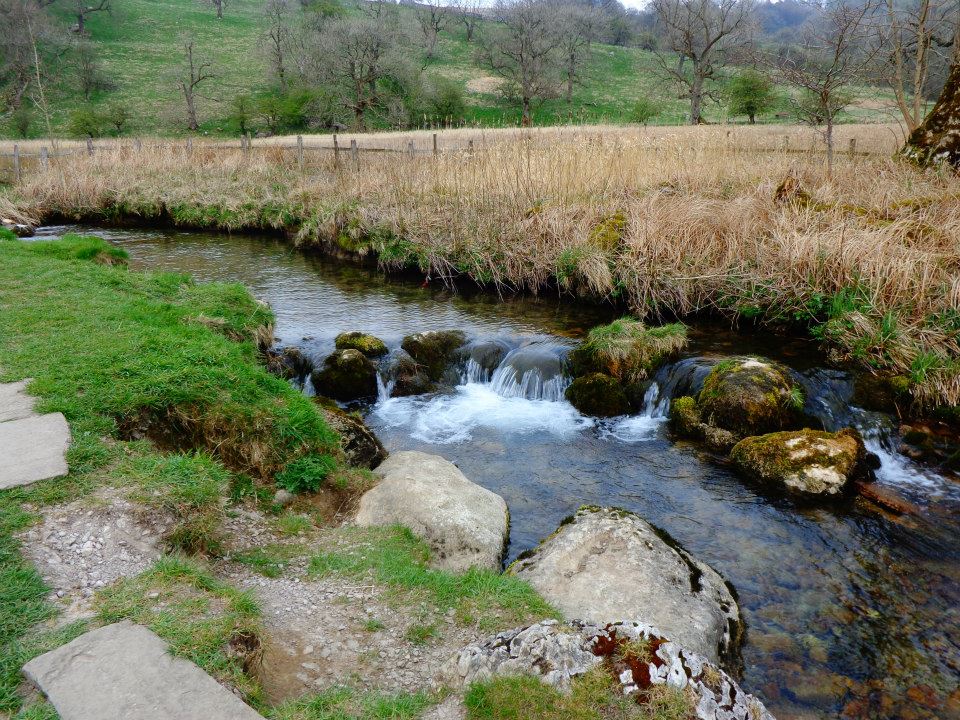
| Goredale Beck |
 |
| Possibly Janet's Cave |
 |
| Janet's Foss |
Heading up and out of there I continued on to Goredale Scar:
 |
| Easy path up to Goredale Scar |
 |
| Getting nearer |
 |
Goredale Scar
The photo doesn't do it justice |
More adventurous folk clamber up the scar, dodging the waterfall that cascades down as they go. Maybe one day... but not today!
I simply retraced my steps and had a meal in the pub in Malham before returning to my accommodation.
Monday, 21st April 2014
Today's walk was a circuit around Malham Tarn. Most folks seem to include the "foot" of the tarn as part of their walk down to Malham Cove but I found a circular walk on the Yorkshire Dales website of about 4 miles looping around the tarn. A hidden gem of a walk if you ask me.
Some pictures:
 |
| I parked near here and headed off towards Malham |
 |
| Views over Malham Tarn towards Great Close Hill |
 |
| Malham Moor Smelt Mill Chimney |
 |
Follow these markers for the walk
- a lot of it is footpathless! |
 |
| Approaching the popular Tarn Foot |
 |
| Terns on the Tarn! |
 |
| Following the path to Malham Tarn House (field centre) |
 |
| Quirky Curiosities! |
 |
| This is actually a small toilet block! |
 |
| Peaceful sunken lane |
 |
| Views over the tarn towards Malham |
 |
Boathouse
(I stopped here a while for a paddle and a cuppa) |
 |
| I followed the blue route anticlockwise |
 |
| Crossing Tarn Moss |
Tarn Moss was quite eerie really. Lots of hidden gurgling as the water seeps through the sponge-like peat. Luckily there were boardwalks to walk on though.
After returning to my car I travelled home.
A lovely walking weekend in perfect weather.
Thanks for looking 😊