Tuesday, 7th August 2018
I've had a couple of days off work so I thought I'd head north to the slightly cooler weather to see how the heather was coming along on the moors.
I got parked up at Saltersgate car park on the A169 - it's run by the National Park and reasonably priced - £2.50 for 4 hours and over.
Some info boards in the car park:
Most people park here to "do" the Hole of Horcum walk which is directly opposite the car park. It's an impressive hole in the ground and a walk I've done before. I didn't fancy doing it again. Nothing against the walk, I just wanted to be up high on the heather moorland to be amongst all that purple loveliness.
I played a game of frogger as I crossed the busy A169 and turned right to follow the path of the Tabular Hills Walk - a 48 mile long distance walk.
The Hole of Horcum:
It doesn't look that impressive in the photograph but it is, trust me.
Reaching the Open Access land I had more of a signpost OCD moment:
Given the recent spate of wild moorland fires, I am surprised, but pleased, that the North Yorkshire Moors seem to have escaped such devastation.
Immediately after the gate I had to decide which path to take. One of them took me up and over the moors - I've walked it before from this gate - the other turning off to the right and skirting the lower edges of the moorland plateau. I chose the latter with a plan forming in my mind that I would "try to find" Skelton Tower - a ruined shooting lodge/folly?
Much of the early part of my walk looked like this:
Thank goodness it wasn't raining!
Looking back across Lockton High Moor to Fylindales:
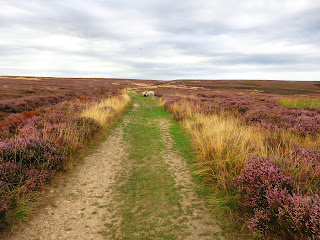
Eventually, my path became much easier and I bounced along the parched dry peat and sand ground. It squeaked underfoot!
There was evidence in places that the ground would be much more squishy in normal UK conditions but this prolonged heatwave and dry spell made it easy and pleasant walking.
The sun, when it came out was fiercely hot, tempered only by a puff of occasional breeze. Thankfully, there were quite a few clouds around to hide the sun from time to time.
Away from the road it was so peaceful until I heard the roar of an engine high up on the moor. I assumed a motorbike or quad bike but, no! it was an aeroplane flying pretty low over the hilltop:
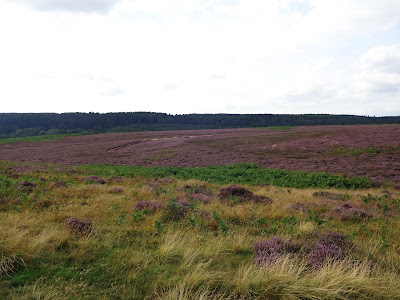
The heather doesn't seem to be at it's purpliest yet, perhaps because of the dry weather but it is blooming earlier this year:
There's three types of heather; the paler pink heather at the top of the pic is Ling heather and the darker, larger, deeper coloured heather in the middle is Bell heather (I forget the name of the third type of heather):
All of a sudden, there in the middle distance was Skelton Tower:
It didn't seem to get any closer for ages!
Eventually I passed the disused quarries. They must have been disused for quite some time as there are some mature trees growing in there!
Finally, I rounded the corner and there it is - Skelton Tower:
I decided to stop and have my late lunch here, looking down on the Pickering to Whitby railway line:
Brew with a view:
This is possibly one of the last "proper" outings my walking shoes will have because the soles have worn thin and the stitching's become unstitched. I'm also fairly sure the internal structure has failed too, but, they're still good for easy ambles of this nature.
My patience was rewarded as a steam train puffed along:
After a good, long while it was time to head back and take the high moorland walk along the Tabular Hills Walk.
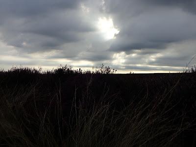
Not that you can see it well (or at all!) in this picture but the clouds have rainbow edges. It looked better in real life - honestly!
Looking back towards Skelton Tower and the path up the hillside I took:
More failed attempts at arty-farty sun/rainbow cloud capturing:
I give up! Though I do quite like the last one with the flash highlighting the foreground grasses.
I was heading towards Dundale Griff Pond .... then I spotted cows! NOOOOOOO. Even though they were the cute, cuddly Highland cattle, they were right on the path. And, after watching one of them chasing sheep out of it's patch, I decided to take a heather-hopping detour off-piste to avoid them. Cue a bit of walking on a bearing across this:
Once upon a time I'd not have dared do something like that but, since my bit of nav practice with a forum member up on the moors near Guisborough, this seemingly featureless terrain no longer worries me. I've never done it in poor visibility though and I hope I never have to.
To be honest, heather hopping was easy due to the dry conditions under foot. I tried, for the most part, to avoid walking on the heather itself and twisted and wound my way around it using any patches of rough grass or followed any sheep trods that were heading in generally the right direction. I knew I would meet the massive "handrail" of the Tabular Hills Walk path eventually, and it didn't matter whereabouts I joined it so long as I turned left once I got to it.
I had in my sights in the distance a large forest - Dalby Forest - and I headed towards the prominent slope of Blakey Topping.
One thing that amused me was, I had to cross a ditch to get on to the track (luckily it was dry as a bone) and, as I stood in the middle of it I couldn't help but think it was a massive ancient linear earthworks of some sort. I was surprised it wasn't marked on the map.... though there are many things on these moors that aren't marked on the map. In the past I've come across stone circles, burial mounds, old sheepfolds. Aye, these moors aren't mapped quite as accurately as, say, the Yorkshire Dales.
I do have to confess at breathing a sigh of relief when I reached the path though:
Successful navigation challenge completed, I knew I was following this path for a good couple or 3 miles so I relaxed a bit and just pootled along.
I came across a plaque telling me the huge ditch I crossed was indeed an iron age dyke:
And here it is. Doesn't look like much but it goes on for miles and miles and really is quite noticeable when you're walking alongside it:
I sat for a while and had snack stop number 2, just enjoying the views, the clouds wafting patterns on the moors, the buzzzzzz of the bumble bees, the smell of the heather. Possibly one of the most soothing and calming experiences to be had ... and it costs nowt.
Feeling suitably relaxed and refreshed I continued on.
I managed to avoid squishing this little fella:
Seavy Pond, dry as a bone:
I'm quite happy to walk amongst sheep, just not cows!
As I took one last look around me before dropping back to the gate I'd entered at the beginning of the walk, I spotted this much nicer plaque than the tatty old info board on the other side of the gate:
Well, thank you Levisham Estate for a smashing 6.5 mile walk.
Couldn't fault the weather - perfect walking weather to be honest - much cooler than the temperatures I left earlier in the day, and a nice breeze to go with it. I still managed to catch the sun though!
Thanks for looking 😊


