Tuesday, 20th August 2019
This is the first "proper" walk I've done in ages. And I suffered and had to cut it short. I can't believe how my fitness has dropped off. Granted, I'm only just recovered from a horrible cough and summer cold so maybe that had an impact on my stamina.
Anyway, even though it ended up being a shorter version of my intended walk I really enjoyed it and it was just what the doctor ordered.
I parked up at Saltergate Car Park and paid my £2.50 for all day. I don't think that's bad at all. I got my rucksack sorted, shoes on and ViewRanger locked on and tracking and set off the short distance along the very busy A169 before taking a right-turn along Old Wife's Way which I think is part of the 48 mile Tabular Hills LDP.
 |
| Turning off the busy A169 |
 |
| Entering MoD perimeter land |
 |
| Thank goodness I'm not going through there! |
The track went on forever and I was mildly aware that it was heading gently downhill - which meant I'd have an uphill finish.
Before long, I spotted my goal for the day - Blakey Topping. I was expecting it to be full of purple loveliness (that'll be heather for normal folks not obsessed) but I'm either too early, too late or it's not a high enough altitude:
 |
| First glimpse of Blakey Topping |
 |
| Blakey Topping again |
 |
| National Trust Sign |
 |
| Finally, a little patch of heather |
Eventually, I left the Old Wife's Way track and headed along a wooded single track path, although I am still on the Tabular Hills path.
 |
| Pointless gate |
 |
| Peacock Butterfly |
 |
| The beginning of my descent of Crosscliff Brow |
The path headed steeply downhill and I was glad the ground underfoot was dry. What I wasn't glad about though was it was about now I realised I'd left my walking staff at home. I really could have done with it here.
Down, down, down I went until I entered the conifer plantation of the northern edge of Dalby Forest:
 |
| Less pleasant conifer plantation - Dalby Forest |
Eventually I passed through a gate and reached Crosscliff Beck. Now, I was imagining a nice babbling brook. Mebby some Salmon leaping up it and a Kingfisher or two darting about. Nope. It was one of those becks you can hear but you can't see. Brilliant. And I had to cross it. To add insult to injury, the path sort of disappeared and I bushwhacked through head high bracken. Looking at my ViewRanger track afterwards, this was indeed the correct thing to do and I crossed the beck at exactly the right spot after scouting about a bit to see if there was a bridge, plank of wood, something, ANYthing to indicate I was on the right track.
After crossing though, it all went a bit pete tong. The newly erected fencing doesn't match with what's on the map and I followed a sheep trod for a while which ran parallel with the beck. The thing is, I was looking back at Blakey Topping and thinking "I need to be taking a sharp left soon to head up Thompson's Rigg". I guess I got a bit impatient of following a pretend fenceline, or maybe the sheep-trod petered out and turned into a boggy mess so I had a little looksee at the map and decided that, to join the track on Thompson's Rigg I needed to go a bit off-piste and plodge across the scrubby moorland. Being near the beck and the moorland rising gently upwards away from me, I had no line of sight of anything but scrubby grassland and a few sheep. So, I decided to walk on a bearing across it all until I reached the track I was wanting to be on (I hoped the track would actually exist as many moorland tracks don't).
As I crested the brow of the hill I still couldn't see any sign of a track but I could see a tree in the distance so I put my compass away and aimed for that. I could see a dark band of different grasses stretching across the moor and sort of thought that might indicate the track I was looking for. I wasn't wrong.
 |
| Looking back from the track to the woodland I walked through |
I decided to get a bit arty-farty and use the self-timer thingy on my camera for an "action shot":
 |
| Me, walking along Thompson's Rigg towards Blakey Topping (in the distance) |
 |
| Blakey Topping without me spoiling the view! |
 |
| Harebells - my snack stop view |
Worse though, was my legs. They felt shot. I can't believe how lack of walking hills for any length of time really has a negative effect.
I looked up at Blakey Topping, now looming above me. I took one look at the path snaking its way up the nose of it... and decided I wasn't up to it. It was too soon after my cough/cold and I simply wasn't fit enough.
I made the decision to not climb the hill and continued on towards Newgate Foot. I passed the standing stones and tried to figure out what they were all about. Allegedly the remains of a stone circle, I'm more inclined to think they're the remains of some sort of gateway structure:
 |
| Standing stones at Newgate Foot |
 |
| You can't walk here |
 |
| National Trust sign for Blakey Topping |
As I rounded the corner I was greeted by two equine heads peeping over stable doors so I went over to give them a pet. They seemed quite focussed on the nearby farmhouse and I assumed it was nearly feeding time.
I successfully navigated the next metal fencing without causing chaos just as farmer chappie came out to see to the horses. I thought I'd best "fess up" about the fencing ... he didn't seem surprised! Oh the embarrassment!
It was a fairly stiff uphill back to the Old Wife's Way track and I needed a few stops for my legs. But I was pleased that I'm no longer wheezing or struggling to get my breath, and boy did I gulp in some big lungfuls of fresh air!
Back on my outward track it was the steady, gentle uphill plod back to the car. The cows had vanished from the gate but I did spot a female Wheatear sat on a fencepost. She allowed me to chase her up the track for a fair old distance before deciding she was too far from home.
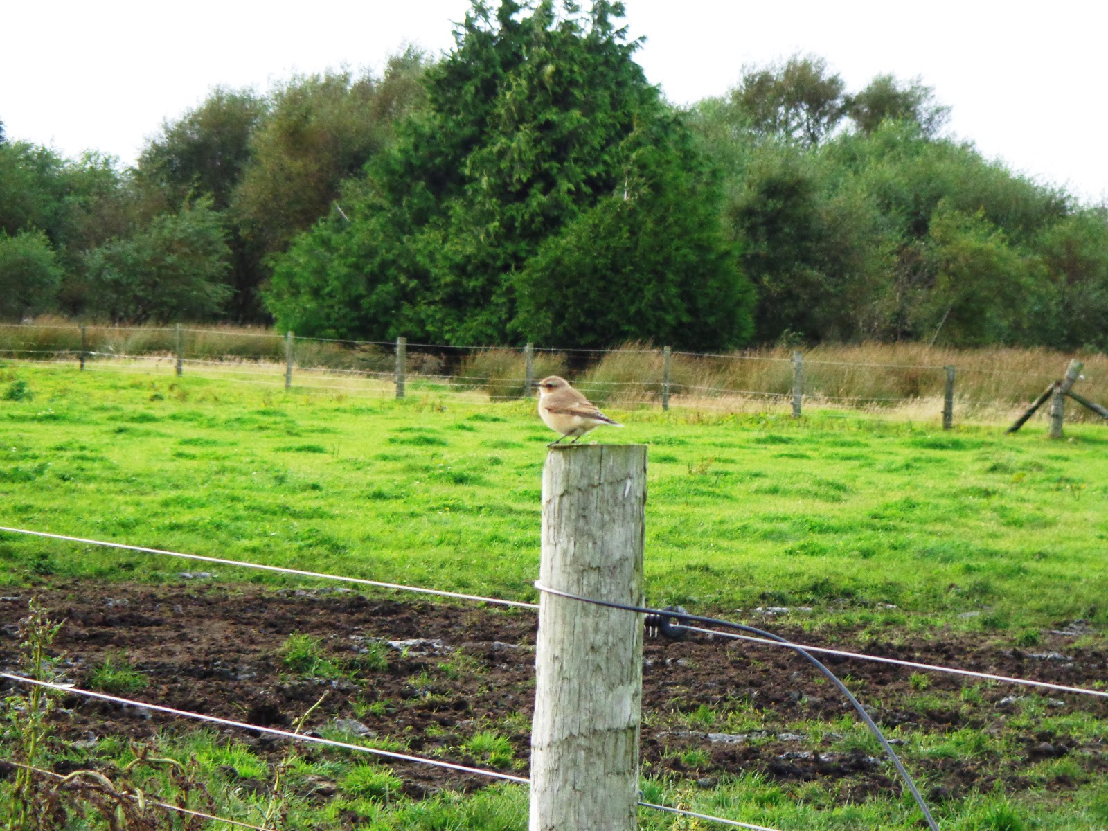 |
| Female Wheatear |
I returned to my car (disappointed to discover the ice cream van had gone) and sat and had my food and flask before setting off home.
Although it wasn't quite the walk I intended to do, and there wasn't much in the way of heather to get all excited about, it was a smashing little walk. I'm really pleased that my tendon didn't give me any gyp whatsoever and that my breathing is what I'd call normal again. Just need to work on the leg and foot stamina now!
I will be back to do the other part of my walk and get to the top of Blakey Topping.
Parking: Saltergate Car Park (£2.50 for over 4 hours)
Distance: 5.3 miles
Max height: 939.8 ft
Thanks for looking 😊